A passage that changes the idea of what a yacht is for
Most cruising itineraries are built around arrival. Norway is built around the travelling. Sail north from Bergen and the water narrows, the walls rise, and within a day the boat is moving through a corridor of rock that is sometimes less than a kilometre across and more than a kilometre deep. There is no swell to speak of. The wind arrives in catspaws, then gusts, then vanishes. Waterfalls fall directly from the cliffs into salt water. Farms sit on ledges that look unreachable except by boat. The sense of scale is not the horizontal, postcard scale of the Mediterranean. It is vertical, and it is close.
The question worth asking is not whether northern Norway is beautiful, because it obviously is. It is whether a fjord and Arctic passage suits the yacht you own or charter, the season you can travel, and the kind of crew you have. Those three answers decide everything else.
Where the fjords actually begin
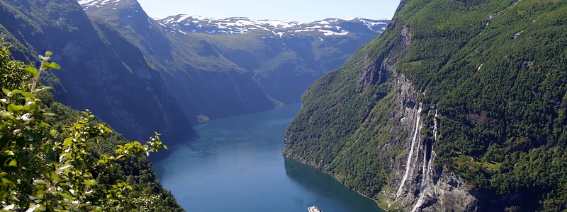
The classic southern approach is from Bergen, and the first serious detour is north and inland: the Hjørundfjord, then Ålesund as a provisioning stop, then Geirangerfjord itself. Geiranger is roughly 15 kilometres of water between walls that climb to well over a thousand metres, with the Seven Sisters and the Suitor waterfalls facing each other across the channel. It is UNESCO-listed, it is busy in July and August with large cruise ships, and it is still worth doing. The trick is timing: arrive early in the morning or late in the evening, when the day boats have gone and the light rakes across the cliff faces.
Just south of there, the Nærøyfjord is the narrowest of the well-known channels, in places little more than 250 metres wide, with a shallow-looking arm of water that is in fact deep enough for a substantial yacht. Anchoring opportunities are limited and often prohibited in the inner sections, so this is a passage to plan as a transit with a stop outside, not a place to spend the night swinging.
Beyond the postcard fjords, the less-visited channels between Ålesund and Trondheim are where the passage starts to feel like an expedition rather than a tour. Little traffic, working fishing harbours, and a coastline that fragments into thousands of islands.
Crossing the Arctic Circle
The Arctic Circle sits at about 66 degrees 33 minutes north, and crossing it is a useful psychological marker. Beyond it, the cruising ground changes character. The Helgeland coast south of Bodø is a low, bright archipelago of granite and shallow water, with the Svartisen glacier inland. Bodø is the last genuinely city-scale stop before the north thins out, and the place to take on serious provisions and any spares you have not already sourced.
Then Saltstraumen, one of the strongest tidal currents in the world, where a narrow strait forces an enormous volume of water through in a few hours. Reported peak speeds vary with tide and source but reach the high teens of knots and occasionally beyond. This is a passage to time around slack water and to treat conservatively, particularly in a heavy displacement yacht with a single engine.
Lofoten is next, and it is the section most crews remember longest. The wall of peaks rises straight out of the sea, the water between the islands is a pale, unlikely turquoise, and the fishing villages still function. Reine, Å, Nusfjord, Henningsvær. Stockfish racks stand in the fields in spring. In summer, the sun does not set. In winter, the islands are quiet and the light is extraordinary, but the sailing window is short and the weather unforgiving.
Tromsø, Senja and the northern reaches
Tromsø, at almost 70 degrees north, is the natural base for the last third of the passage: a proper town with yards, engineers, chandlers and flights home for crew changes. From there the options open out. Senja to the west is a smaller, wilder version of Lofoten. The Lyngen Alps offer deep water almost directly beneath steep skiing terrain. The Trollfjord, off the Raftsundet, is short, dramatic and only around 100 metres wide at its mouth, which makes it a passage to enter in settled conditions with a plan for turning around.
North Cape and the North Sea route to Kirkenes mark the end of mainland Norway. Beyond it, the Russian border and the Barents Sea, which is a different piece of water altogether.
Svalbard: different rules, different boat
Svalbard sits around 78 degrees north, roughly 600 nautical miles north of Tromsø across open water. It is not an extension of the fjord cruise. It is a high-Arctic voyage with its own risk profile: ice, fast-changing visibility, very limited rescue assets, and an environment where a mistake on a shore landing can become a serious polar bear encounter. The archipelago's environmental regulations restrict landings in most protected areas, require advance notification of voyages and expect documented polar bear precautions and firearms competence aboard. Reputable operators travel in company, carry appropriate insurance, and brief guests properly. This is a leg to plan with a specialist rather than to improvise.
The season question
The two viable windows are effectively opposite experiences. From late May to mid-July the midnight sun delivers long days, settled-ish weather, and access to places that are otherwise winter-locked, but the water is cold, the air colder, and fog in the inner fjords is common. July and August bring the warmest conditions, the longest daylight that still includes a proper night, and the greatest volume of other traffic. From late September the aurora season begins: fewer boats, dramatic light, and a steadily shrinking margin for error as days shorten and low pressure systems arrive in succession.
For anyone sailing south of the Arctic Circle, the shoulder months are the sweet spot: June or September. For Lofoten and Tromsø, mid-June to early August. For Svalbard, the practical window is narrow, typically late June to August, and dictated by ice.
Weather, sea state and what the charts do not tell you
Norway's coastal weather is well forecast and well served, with tight, reliable models and frequent updates. The real difficulty is not the forecast, it is the topography. Wind accelerates through mountain gaps, bends around headlands, and appears offshore without warning. A twenty-knot day in open water can become forty knots in a specific sound. Local pilots and harbourmasters are worth calling; the Norwegian coastal pilotage is deep and the locals know which anchorages are untenable in which direction.
The other thing that surprises crews from southern Europe is that the open sea passages between the island groups can be genuinely uncomfortable. The stretch across the Vestfjorden to Lofoten, and the Barents Sea beyond North Cape, can produce steep, short seas that stop a boat quickly. Weather routing matters more here than in most cruising grounds, and a comfortable weather window is worth waiting two days for.
Anchoring in the fjords is its own skill. Depths fall away almost vertically, so anchoring in the textbook sense is often impossible. Mooring to rock with a stern line, a technique borrowed from Norwegian small-boat practice, is widely used and works well. Many crews simply use the extensive network of small harbours, guest pontoons and fishing quays, which are generally good value and often the more sociable option.
Provisioning, fuel and crew logistics
Norway is expensive in a way that surprises people who are used to Mediterranean marina bills, though fuel itself is not the worst of it. Alcohol is heavily taxed and restricted in retail sale, so plan accordingly. Fresh food is excellent but priced accordingly, and the further north you go, the fewer the options and the shorter the opening hours. Provisioning in Bergen, Ålesund, Trondheim, Bodø and Tromsø is straightforward; between them, treat every town as the last one.
Fuel berths are frequent along the main coastal route but thin out on the outer islands. Range anxiety is real on a long displacement passage with a modest tank, particularly if weather forces slow running or a diversion.
Crew changes are practical at Bergen, Trondheim, Bodø, Tromsø and Kirkenes, all with reliable connections. For a privately owned yacht, this is often the deciding logistical factor: a two or three-week window works if it is anchored to those airports.
What it costs
A rough sense of the shape of the budget rather than the number: fuel for a thousand nautical miles at displacement speed is modest for a motor yacht and negligible for a sailing yacht; dockage is spread across many small, reasonably priced harbours rather than a few large marinas; and the largest costs are crew, insurance extension into the Arctic, and the time itself.
For anyone weighing a charter instead, the day rate plus fuel, food and crew gratuity is the honest basis for a comparison, and our Charter Cost Calculator will run those numbers against your own assumptions. For owners considering the purchase of a boat specifically for this kind of cruising, the Cost of Ownership Calculator puts running costs and depreciation in the same frame, which is usually the more sobering of the two.
Is it for you?
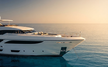
Norway rewards a yacht that is comfortable in cold, wet conditions and a crew that is patient with weather. A large flybridge with generous outdoor entertaining space and no covered aft deck is a compromised choice here; a pilothouse, an enclosed helm and a good heating system transform the experience. Shallow draft is less useful than it sounds in the fjords, but seakeeping and fuel range matter enormously.
The honest answer to the question in the title is this: if you want warm water, short passages between anchorages and long dinners ashore in the evening, the Mediterranean does it better and cheaper. If you want to move through landscape on a scale that resets your sense of what a coastline is, and you are content to let the weather set the schedule, then northern Norway is one of the great passages left in Europe. The boats that do it well are not the biggest ones. They are the ones whose crews planned the season properly and then waited for the right morning.